Rand McNally Road Atlas: Large Scale
GPS reroutes you. A road atlas shows you where you are — which is different, and matters more when the signal drops at mile 200 of a rural route through the Tennessee highlands.

What happens when GPS fails on a road trip
Tennessee's Natchez Trace Parkway runs 444 miles with no commercial development, minimal signage, and cellular dead zones that last 30 to 40 miles at a stretch. Georgia's Route 197 through the Chattahoochee National Forest connects some of the most scenic driving in the state — and runs through areas where GPS rerouting sends you down logging roads that aren't roads in any practical sense. California's Highway 1 at Big Sur loses cell signal for hours at a time, and Google Maps' suggestion to 'make a U-turn' when a slide closes a section offers nothing useful. A physical road atlas doesn't give you turn-by-turn — but it gives you the bigger picture that GPS strips away: where are you relative to the route, what towns are ahead, which road is actually parallel if you need an alternative. That spatial awareness is what GPS navigation eliminates and what gets you unlost when cell service disappears.
What we looked at first
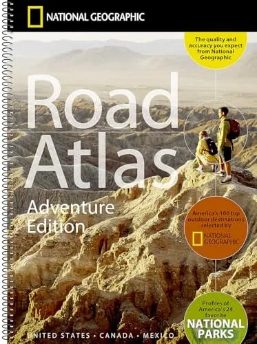
We looked at the National Geographic Road Atlas: Adventure Edition and it is genuinely excellent — it adds national park boundary maps, back-road highlighting, and scenic byway callouts that the standard Rand McNally doesn't include. It's the better atlas for national park road trippers. The tradeoff is price (roughly $20 more) and coverage density — it emphasizes scenic routes at the expense of comprehensive secondary road coverage in states without major parks. The Rand McNally Large Scale wins on utility for the most common road trip format: city-to-city across multiple states, mixing interstates with state routes, with national parks as stops rather than the organizing principle. If your trip is primarily a national parks circuit, buy the National Geographic version. If your trip visits cities, small towns, and parks as a mix, the Rand McNally is more useful.
What you get
- Large-scale state maps — each state printed large enough to read from the passenger seat without squinting; the standard (non-large) edition requires a magnifying glass for rural county roads
- Complete secondary road coverage — state routes, county roads, national forest access roads, and scenic byways that GPS databases frequently mislabel or omit
- Mileage charts between major cities — useful for the daily math of how far you're actually driving before you drive it
- Updated annually — current edition reflects road changes, construction bypasses, and new route designations that older atlases miss
Who this is for
Anyone doing a multi-day road trip of 500+ miles through a mix of states — specifically road trippers who plan to use state routes and scenic byways rather than staying on interstates the whole time. Travelers going through rural areas of Tennessee, Georgia, or the Southeast where cell coverage has genuine gaps. Families with a navigator in the passenger seat who wants to follow the overall route rather than stare at a phone screen for six hours.
Where to use it on your trip
The Natchez Trace Parkway in Tennessee and Mississippi — a federal parkway with no commercial interruption and cell dead zones for dozens of miles at a stretch; an atlas tells you where you are in relation to the next exit town, which GPS cannot do without signal. Georgia's Route 197 and the Chattahoochee National Forest road network — GPS mapping of forest roads in this area is inconsistent; the Rand McNally shows which routes are paved state routes versus access roads. California's Highway 1 through Big Sur — the coastal route is subject to closure and detour; the atlas shows the parallel US-101 option and the geography of the detour before you've committed to a direction.
Who should skip it
Travelers doing a single-city destination trip (fly into New York, stay in the city for a week, fly home) don't need a road atlas — there's no navigation problem to solve. Interstate-only drivers who plan to use the GPS the entire trip and stay on major highways with consistent signal can skip it.
Our take
Buy this for any multi-state road trip that will take you through rural areas, scenic routes, or national forest roads — specifically anything that goes through Tennessee, Georgia, or rural California where GPS reliability is inconsistent. The large-scale edition is the only version worth buying; the standard edition's print size is too small for in-car use. Skip it for single-city urban trips where navigation is never the variable.
We may earn a commission if you purchase through our link, at no extra cost to you.